Jacksonville Duval County 904-346-1266
St Augustine St Johns County 904-824-7144
Orange Park Clay County 904-264-6444
Jacksonville Beaches Duval County 904-246-3969
Fernandina Nassau County 904-277-3040
Macclenny Baker County 904-259-5091
Palm Coast Flagler County 386-439-5290
Daytona Volusia County 386-253-4911
Serving all of Florida and Georgia at 904-346-1266
EMAIL LARRY@1STPROP.COM (feel free to email your bidding packages here)


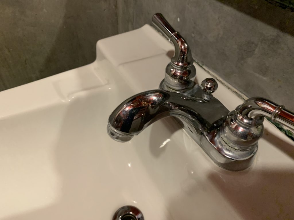
Irrigation repairs
New irrigation systems
Zone valve installation, location, and repair
Timer boxes
Rainbird irrigation systems
Toro irrigation systems
Sprinkler head repairs
New construction, industrial, commercial, residential
all phases of irrigation repairs
Backflow testing and certification
pipe repairs
water leaks
large water bill analysis
pump repairs
jet pump repairs
shallow well installations
water meter replacement or new installation
water pumps
well pumps
wells
pipe
winterizing
supply
systems
drip irrigation systems
winterization policy and follow up
sprinkler systems
farm irrigation systems
parts
insulation
troubleshooting your irrigation system
inpection and maintenance contracts
monthly inspection services
pumps
valves
controls
controllers
zone valves
Growing and maintaining a beautiful lawn in Jacksonville requires a well-tuned irrigation or sprinkler system. Without one, you will spend hours each week dragging a hose around the yard. If you have a sprinkler system, but it is old or in need of repair, you will waste water and money, and still have a dried up or patchy yard. To maintain a pretty green lawn, you need a good irrigation system, in working order, and a top-notch maintenance company to call when trouble hits.
What can go Wrong with Your Sprinkler System
Irrigation systems are notoriously finicky and difficult to manage. From homeowner lawns to giant commercial irrigation systems, any number of things can happen that will derail the operation and necessitate irrigation system repair.
Potential Problems
- Popup spray heads cease to pop up
- Rotary spray heads cease to rotate
- Nozzles and small tubing clogs with dirt or other debris
- Spray heads are run over with the lawnmower or kicked
- A power failure re-sets the system incorrectly
- A contractor cuts through a pipe
- Spray heads spring leaks
- Tubing becomes kinked
- Valves leak
- Filter screens become clogged
FOR MORTGAGE COMPANIES WE CAN INSPECT ALL PHASES OF WORKMANSHIP AND QUALITY CONTROL
FREE ESTIMATES, LICENSED AND INSURED.
We accept all major credit cards. Visa, Mastercard, Discover and American Express.
We service the following areas of northeast Florida: Jacksonville, Jacksonville Beach, Atlantic Beach, Neptune Beach, Ponte Vedra Beach, Fernandina, Amelia Island, Callahan, Yulee, Hillard, Macclenny, St George, St Marys, Kingsland, Orange Park, Middleburg, Green Cove Springs, Penny Farms, St Augustine, Hastings, Palatka, Keystone Heights, Starke, Lake City, Waldo, Baldwin, St Augustine Beach, Crescent Beach, Palm Coast, Daytona, Holly Hill, Titusville, Daytona Shores, Ormond Beach, Bunnell, Deland, Orange City, Port Orange, Orlando, New Smyrna Beach, Sanford, Palm Valley, Fruitcove, Mandarin, Lawtey, St. Augustine Beach, Switzerland, Vilano Beach, Marineland, Flagler Beach, Beverly Beach, Sanderson, and Glen St. Mary.
STATE CERTIFIED PLUMBING AND IRRIGATION CONTRACTOR
LICENSE NUMBER CFCO56659
NOW HIRING
apply for a job online at www.asapapply.com
To get a FREE ESTIMATE CALL 904-993-3433
OR CLICK BELOW AND PLACE A WORK ORDER
IN OUR AUTOMATED WORK ORDER SYSTEM
http://www.asap-plumbing.com/Submit_a_New_Work_Order/submit_a_new_work_order.php
Serving the entire Jacksonville area including the following communities:
Neighborhoods of Jacksonville, Florida
As the largest city in land area in the contiguous United States, Jacksonville is divided both formally and informally into a few large sections. Though most residents divide the city into Northside, Southside, Westside, and—increasingly over the past decade, Arlington—Jacksonville’s official website divides the city into six major sections:[1]

Sections of Jacksonville
- Greater Arlington, more commonly known to Jacksonville citizens simply as Arlington, is situated east and south of the St. Johns River and north of Beach Blvd.
- North Jacksonville is officially designated by the city website as everything north of the St. Johns & Trout Rivers and east of US 1. Much of this area is known by Jacksonville residents as the Northside, though much of what is called “Northside” does not fall within these boundaries, and much of what falls within these boundaries has not been traditionally known as “Northside”.
- Northwest Jacksonville is located north of Interstate 10, south of the Trout River and surrounds the downtown section. The parts of this area between US Highway 1 and the Trout and St. John’s River is usually considered part of either the “Northside” or, alternately, Downtown. Much of this section is actually rural land, not easily classified as part of any section.
- Southeast Jacksonville, almost universally known as Southside, refers to everything east of the St. Johns River and south of Beach Blvd.
- Southwest Jacksonville makes up most of what is known in Jacksonville as the Westside, though parts of Northwest Jacksonville also are considered part of the “Westside”. It consists of everything west of the St. Johns River and south of Interstate 10.
- The Urban Core, most of which is commonly known as Downtown, includes the south & north banks of the narrowest part of the St. Johns River east from the Fuller Warren Bridge and extending roughly 4 miles (6.4 km) north and east.
With the rapid growth in the eastern part of Duval County, the Intracoastal/Beaches/Ponte Vedra area is viewed by many as a major section as well, but is not generally included in a Jacksonville list since they lie outside of the Jacksonville city limits. There is also a distinct part of the city known as “Eastside” which those unfamiliar with Jacksonville’s overall geography sometimes mistakenly regard as one of the major divisions of town, rather than the localized neighborhood which it is.
Today, what distinguishes a “section” of Jacksonville from a “neighborhood” is primarily a matter of size and divisibility. However, definitions are imprecise, and sometimes not universally agreed upon.[2]
Each of these sections not only encompasses a large area, but also, each is divided into many neighborhoods. Each of these neighborhoods, in turn, has its own identity.
Each of these sections is divided into many neighborhoods. Some of these neighborhoods, such as Mandarin and LaVilla, had existed previously as independent towns or villages, prior to consolidation, and have their own histories.
Sections
North Jacksonville
Sandalwood
The Sandalwood neighborhood began developing in the spring of 1960, midway between downtown Jacksonville and the beaches, or about 6 miles (9.7 km) from each, was advertised in 1960-61 as “On the Southside – halfway between business and pleasure!” The builder-developer, Pearce-Uible, was located at 3850 Beach Blvd.
The original neighborhood was bordered by the then two-lane Atlantic Boulevard on the north, a mile of palmetto and scrub on the south before reaching Beachwood neighborhood and Beach Boulevard, the western part of the neighborhood was bordered by the less than two-lane dirt road named St. John’s Bluff, and the eastern border of the neighborhood was defined by a storm drainage ditch called the Sandalwood Canal. The original streets are named after mostly South Pacific islands and most of the streets are, from north to south, in alphabetical order. The original street names are Aloha Drive; Batavia Drive; Caledonia Drive; Delago Drive; Eniwetok Drive; Fiji Court; Hawaii Drive East; Hawaii Drive South; Indies Drive North; Indies Drive East; Indies Drive South; Java Drive; Kuralei Drive; Mindanao Drive (The main drag); Sandalwood Boulevard (Original main entrance road); Bahia Drive; Dulawan Drive; and Kusaie Drive.
The were eight original home styles named as follows: Aloha; Bahama; Bikini; Caledonia; Del ray; Java; Polynesian; and Waikiki. Free airplane rides over Sandalwood were offered during the grand opening. The entrance and sales office located on Sandalwood Boulevard boasted a winding, palm lined street, and adjacent play area for the children. Homes were priced from $11,400 to $16,000, with monthly payments as low as $67. The original Sandalwood consisted of approximately 500 homes. The first families purchased homes in May and June 1960. Many of the first families were U.S. Navy families who were stationed at the Mayport base and others were employed by CSX railroad.
In the late 1970s, additional construction began at the southern border by the Sofranko Homes company, nearly doubling the size of the neighborhood. Most of the original early 1960s families have moved away over the years, but a handful of the original families are still left from the early 1960s.
Southeast Jacksonville
Neighborhoods include Arrowhead, Avenues, Bayard, Baymeadows, Baymeadows Center, Beach Haven, Beauclerc, Bowden, Brackridge, Brierwood, Craven, Deercreek, Deerwood, Deerwood Center, Del Rio, Englewood, Goodbys Creek, Greenfield Manor, Greenland, Isle of Palms, Julington Creek, Kilarney Shores, Lakewood, Loretto, Mandarin, Mandarin Station, Miramar, Montclair, Pickwick Park, Pine Forrest, Royal Lakes, San Jose, San Jose Forrest, San Marco, Sans Pareil, Sans Souci, Secret Cove, South Riverside, Southpoint, Southwood, Spring Park, Sunbeam, Tiger Hole and Windy Hill.
Bayard
Bayard has a rich history that antedates its inclusion in the municipality of Jacksonville. For more information, see Bayard.
Baymeadows
Baymeadows is a relatively affluent neighborhood centered around Baymeadows Road. It is situated south of Arlington (specifically, south of J. Turner Butler Boulevard) and east of Mandarin. A center for white-collar employment, it is home to many corporate office parks, upscale apartment complexes and residential developments, two private golf courses, several shopping centers and a large shopping mall. Deerwood and Hampton Glen and East Hampton and Reedy Branch Deercreek
Lakewood
Lakewood, which lies in the area where San Jose Blvd. and University Blvd intersect, is a residential area with houses built in the 1950s. It has several churches, two shopping centers, and a plethora of streets named after major private colleges, such as Clemson, Cornell, Fordham, and Emory.
Loretto
Loretto is a distinct part of the greater Mandarin area, and sits between San Jose Boulevard to the west and Philips Highway to the east. It is bordered to the north by Interstate 295 and to the south by the county line. Loretto was formed by the Catholic Diocese of St. Augustine. In the days of Reconstruction, Loretto sprouted up next to the nuns’ convent, dormitory and school. It is on what became Old St. Augustine Road, the highway between Jacksonville and St. Augustine. According to Wayne Wood’s Jacksonville’s Architectural Heritage, the nuns were sent there to educate both the residents and newly freed slaves. The Catholic Church still owns the property on all four corners of the intersection of St. Augustine Road and Loretto/Greenland Roads. The Loretto area public schools always have been highly regarded; on the FCAT, they’re all rated A, B or C. The average price for homes that become available in Loretto is just under $200K. Many homes are built on some of the largest new construction lots in the area and there are a lot of dead-end streets and cul-de-sacs. Over the length of San Jose Boulevard, residents can find just about every merchant, service or restaurant available in the city. Loretto has a solid, hometown feel, with established neighborhoods, parks and nature areas nearby, making it the proverbial middle America.
Mandarin
Mandarin has a rich history that antedates its inclusion in the municipality of Jacksonville. For more information, see Mandarin.
[Hide]
[Help us with translations!]
| Candidates for the 2010 steward elections are asked to submit their nominations by January 28. Nominate yourself. |
Mandarin, Jacksonville, Florida
Mandarin is a neighborhood located in the southern most portion of Jacksonville, in Duval County, Florida, United States. It is located on the eastern banks of the St. Johns River, across from Orange Park. Mandarin was named after the Mandarin orange in 1830 by Calvin Reed, a prominent resident of the area .
Once called “a tropical paradise” by author Harriett Beecher Stowe, the quaint area of Mandarin is marked by its history, ancient oak trees draped with Spanish moss, beautiful parks, marinas and more water views than any other area in Jacksonville. In the 1800s, Mandarin was a small farming village that shipped oranges, grapefruit, lemons and other fruits and vegetables to Jacksonville and points north on the steamships that traveled the St. Johns River. In 1864, the Union steamship, the Maple Leaf, hit a Confederate mine and sank just off Mandarin Point.
While Mandarin now is just a small section of the City of Jacksonville, its natural beauty, parks and historic buildings draw visitors from around the world. Just a short drive south of Jacksonville’s city center, the community is bordered by Beauclerc to the north, Julington Creek to the south and St. John’s River to the west.
History
Harriet Beecher Stowe
In 1867 the famous author of Uncle Tom’s Cabin, Harriet Beecher Stowe bought a cottage here. For the next seventeen winters, she welcomed tourists debarking from the steamers making their way down the St. Johns River and charged them 75 cents each to meet her and admire her surroundings.
Stowe, although best known for her novel Uncle Tom’s Cabin about the cruelty of slavery, also wrote about Florida.
She had promised her Boston publisher another novel, but was so taken with northeast Florida that she produced instead a series of sketches of the land and the people which she submitted in 1872 under the title Palmetto Leaves. Her second book did not outsell her first novel, but did have the effect of drawing rich and fashionable tourists to visit her.
In Palmetto Leaves Stowe describes life in Florida in the latter half of the 19th century; “a tumble-down, wild, panicky kind of life—this general happy-go-luckiness which Florida inculcates.” Her idyllic sketches of picnicking, sailing, and river touring expeditions and simple stories of events and people in this tropical “winter summer” land became the first unsolicited promotional writing to interest northern tourists in Florida.[1]
A small chapel is dedicated to Harriet Beecher Stowe in Mandarin.
Famous Residents
The late Allen Collins from the rock band Lynyrd Skynyrd resided some of his last years in Mandarin before he passed. Mandarin was also the location where Allen was involved in a car accident during 1986 that left him paralyzed from the waist down and his girlfriend dead.
20th Century
In 1968, the city of Jacksonville and most of Duval County formed a consolidated municipal unit. As part of this process, Mandarin ceased to exist as a political entity, and became part of the City of Jacksonville.
In 1990, with the rapid growth of Mandarin, a new public high school was opened in the area. Several prominent citizens in Jacksonville urged that the new school be named Harriet Beecher Stowe High School, but the proposal did not receive widespread acceptance, and instead the school was simply named, Mandarin High School.
Geography
Mandarin is located at  30°09′37″N 81°39′34″WCoordinates: 30°09′37″N 81°39′34″W (30.1603, -81.6594).[2] / 30.1603°N 81.6594°W / 30.1603; -81.6594 / 30.1603°N 81.6594°W / 30.1603; -81.6594
References
- ^ “Palmetto Leaves”. University Press of Florida. http://www.upf.com/Spring1999/stowe.html. Retrieved 2006-09-06.
- ^ “US Gazetteer files: 2000 and 1990”. United States Census Bureau. 2005-05-03. http://www.census.gov/geo/www/gazetteer/gazette.html. Retrieved 2008-01-31.
External links
San Marco
San Marco is a relatively small and generally upscale neighborhood located south of Downtown and north of Mandarin. Due to large differences in property value, income distribution, and reported crime statistics in a relatively small area, San Marco is diverse. In one block, residences range from low cost, multi-family dwellings to sprawling riverside mansions. It is an area of historical and cultural significance in Jacksonville, and its inhabitants and proprietors identify strongly with their community.
Known as a trendy area, the most identifying feature of San Marco is “the Square,” an artsy shopping, dining, and entertainment district; its galleries, restaurants, and boutiques are overwhelmingly independently owned, operated, and supported which lends to its vogue. Visitors of the Square are likely to see polite intermingling between young professionals, landed gentry, “scenesters,” and “starving artists.”
Common landmarks are its large statue of three lions and the Art Deco styled San Marco Theater.
Sunbeam
Sunbeam is a relatively new neighborhood centered around Sunbeam Road which runs east/west between Philips Highway and San Jose Boulevard. It is situated south of Baymeadows Road, east of Mandarin and north of the Avenues Mall. The area includes the site of the former Sunbeam Sanitary Landfill which opened in 1972. The dump emitted objectionable odors, which discouraged development nearby. The landfill permit expired in 1986, and the facility stopped accepting garbage. After being covered with a 3-foot (0.91 m) deep cap, which prevents the elements from coming in and waste from coming out, the Florida Department of Environmental Regulation (FDER) certified it closed on October 21, 1992. [3] With the odor problem resolved, development resumed in the middle 1990’s including subdivisions, apartment complexes, commercial buildings and the Community Hospice of Northeast Florida center. A golf course on and around the original landfill was planned and delayed for several years but construction finally began in late 2007 and projected to open in Fall, 2008. However, the financial meltdown delayed opening. At the end of 2009, the course was substantially complete but work on a clubhouse had not commenced.
Southwest Jacksonville
.[4]..[5]. Neighborhoods include Argyle, Avondale, Cedar Hills, Cedar Hills Estates, Chimney Lakes, Confederate Point, Duclay, Duclay Forest, Fairfax, Herlong, Hillcrest, Hyde Park, Jax Farms, Jacksonville Heights, Lakeshore, Maxville, McGirts Creek, Murray Hill, Normandy Manor, Normandy Village, Oak Hill, Ortega, Ortega Farms, Ortega Forest, Ortega Hills, Otis, Riverside, Rolling Hills, Settlers Landing, Sweetwater, Venetia, Wesconnett, Whitehouse, Yukon and West Jacksonville.
The Westside is home to Paxon School for Advanced Studies, which happens to be one of the top schools in the nation by academics since 2003. The Westside is also home to some of the most culturally diverse schools in Duval County to date.
Argyle
One of the newest and largest neighborhoods on Jacksonville’s Westside, and occupying a large area of former ranchland, Argyle has grown rapidly from its beginnings in the mid-1980s. Straddling the Duval/Clay county line, Argyle was originally accessible only from Blanding Boulevard in Orange Park. However, as it has expanded westward, Argyle is now connected to Jacksonville’s far-Westside by a number of roads, including the Brannan Field-Chaffee Road corridor that links I-10 directly with Middleburg. Argyle remains a popular choice for middle-class families that are recently settling in Jacksonville.
Avondale
Historic Avondale lies along the St. John’s River southwest of the Riverside area, some three to four miles (6 km) upriver from downtown Jacksonville. Avondale is known for its quiet, tree-lined residential streets and hundreds of quaint homes, most dating from the early 1920s during the Great Florida Land Boom. A few Avondale homes pre-date 1900. Most homes in the neighborhood reflect the middle to upper income taste in residential architecture of the 1920s, including numerous Prairie School, Art Deco, Craftsman Style, Classical Revival, and Mediterranean Revival styles. Avondale is characterized by numerous bungalows and spacious, graceful homes. Unlike some other neighborhoods, Avondale never experienced a period of decline during the latter 20th Century, and retains much of its original gentility.
Two-lane St. John’s Avenue is the key traffic artery through Avondale, and is the location of the Avondale Shops, a small but vibrant collection of specialty shops, clothing stores, cafes, and upscale restaurants, most of which are located in original 1920s structures.
The Avondale Historic District is a U.S. historic district in Jacksonville, Florida. It is bounded by Roosevelt Boulevard, Belvedere Avenue, Seminole Road, the St. Johns River, and Talbot Avenue, encompasses approximately 2730 acres, and contains 729 historic buildings. On July 6, 1989, it was added to the U.S. National Register of Historic Places.
Cedar Hills
Cedar Hills lies along the Cedar River (called Cedar Creek by the locals), on the opposite shore from Lake Shore, and stretches from Blanding Boulevard on the east to Lane Avenue to the west. Built in the 1940s, Cedar Hills consists of some 3,000 single-family brick or concrete block homes in seven different residential neighborhoods that are anchored by the Cedar Hills Shopping Center business district. Most of the homes are modest, although many of the homes along the shore of the Cedar River have been greatly expanded, or replaced with much larger homes.
Confederate Point
Built in the 1960s on reclaimed lowlands, technically a small island surrounded by a moat, with one small bridge as access. Confederate Point lies along the Cedar River (called Cedar Creek by the locals), on the opposite shore from Lake Shore. Confederate Point stretches from the Ortega River to the east, to Blanding Boulevard on the West, and is bordered by the Cedar River to the North, and Timaquana Boulevard to the South. The area consists of approximately 300 large, single family homes, and approximately 700 condos and apartments that line the south bank of the Cedar River. All of the single family homes are inland, with the apartments and condos lining the shore of the Cedar River. The area is popular given that it is close to water, and Downtown, yet also exclusive in that there is only one road in or out.
Lake Shore
Built during the time of the first World War, Lake Shore lies on the curving north bank of the Cedar River (called Cedar Creek by the locals), and stretches from Roosevelt Boulevard on the east, to the Cedar River to the West, and is bordered by the Cedar River to the South, and Park Street to the North, and is bisected by Cassat Avenue. Lake Shore consists of approximately 1,000 modest, wood-frame, concrete block or brick homes, with the exception of approximately 80 quite large estates that line the shore of the Cedar River. The neighborhood is anchored by the Roosevelt Plaza on Roosevelt Boulevard, and the Lake Shore business district of stores up and down Cassat Avenue. Lake Shore is centrally located on the Westside, with quick access to Downtown Jacksonville via Roosevelt Boulevard. Given the small size of the existing homes, the current trend is for first time home buyers to renovate and retrofit these well built homes to fit today’s needs. This is a very well maintained pocket of 1940s and 1950s homes. There is a definite trend to renovate and revitalize this quiet, comfortable neighborhood.
Marietta
Marietta is one of the small farming communities that was absorbed during the 1968 consolidation of Jacksonville with Duval County. Though technically a part of the city proper today, much of Marietta still retains its small-town, and even rural “feel”, with some old-style farms and ranches, and most homes occupying lots of 10 acres (40,000 m2) or more, on which they keep horses and cattle, or raise grain and maintain orchards. Marietta is popular with old Southern families, and new families who moved to Jacksonville from mid-western agricultural states. Companies looking for more space have also found Marietta. The area west of Marietta and east of Whitehouse along Beaver Street is now home to the Publix warehouse, Michael’s warehouse and the Winn-Dixie distribution center.
Normandy
Outside of what would eventually become Jacksonville, and originally called “Hogan Settlement”, The Normandy area was settled by Jacksonville’s “Founding Family”, the “Hogan’s” who were the first white settlers in Duval County. The Normandy area is a large swath of forested high-ground that straddles both sides of Normandy Boulevard, and stretches from Cassat Avenue on the East, out to Herlong Airfield on the West, and is bordered by I-10 to the North, and Wilson Road to the South. Though originally populated by the large ranches of many of Duval County’s founding families such as the Hogans, Lindseys, Fourakers, and the Herlongs, the area is now a bedroom community, containing over a dozen large residential neighborhoods such as Normandy, Normandy Village, Rolling Hills, Country Creek, Crystal Springs, Hyde Grove, Hyde Park, etc, with very few apartment complexes or condo developments. These neighborhoods have their own sewer and water plants, and unlike most wood-constructed homes in Jacksonville’s newer neighborhoods, most homes in the Normandy area are constructed of brick, or concrete block. The area is home to some of the city’s best schools, and parks. Unlike other sections of the city, where people tend to move from home to home every 2 or 3 years; homes in the Normandy area are routinely transferred from generation to generation, and it is not unusual for great-grandchildren to live in homes originally built by their great-grandparents.[6].
Ortega
Historic Ortega lies on the St Johns River just south of the historic Riverside area. Ortega is bordered by the St. Johns River on the East, the Cedar River on the North, and the Ortega river on the West, practically making it an “inland island.” The history of the area includes a number of interesting characters: botanist William Bartram; highwayman and cattle rustler Daniel McGirtt; and Don Juan McQueen, who attempted to establish a plantation on his 1791 Ortega land grant, but was forced to leave due to attacks of Georgians and the French. Gangster George “Machine Gun” Kelly and his wife were rumored to be the mysterious couple who abruptly left their rented Grand Avenue home hours before a midnight police raid in 1933. Ortega is home to hundreds of mid-size to large, turn-of-the-century homes and Southern Style mansions. Many of these homes are situated directly on the river, and the nature of the “island” allows ease of access to the waterways for all residents. Along with Avondale and Riverside, Ortega is home to some of the wealthiest of Jacksonville families. It is marked by a distinctly traditional Southern culture complete with one of the South’s most exclusive debutante coiteries. The island is almost exclusively residential, the only exception being a small square in the section known as “Old Ortega” on the northern end where a small collection of restaurants, boutiques, and a pharmacy are found. Ortega, with its giant oaks, waterfront mansions, and series of parks is widely considered one of the most beautiful residential areas of Northeast Florida.
Paxon
Platted in the 1920s and 30’s, the Paxon area is one of the oldest, pre-platted neighborhoods in Jacksonville. Built due to the redistribution of housing after the Great Fire, the Paxon area replaced the many thousands of homes that were destroyed in the Great Fire with thousands of modest, wood-framed homes. The Paxon area was extensively well-planned with its own schools (originally known as Paxon Sr. High School and Paxon Jr. High School, along with a half-dozen small elementary schools). The area straddles Edgewood Avenue South, and stretches from Mcduff Avenue to the East, and I-295 to the West, and is bordered by I-10 to the South, and I-295 to the North. The area originally contained over 40,000 single family homes in over 15 different residential neighborhoods, all anchored by the Edgewood Avenue, and Beaver Street business districts. However, over time, the area declined due to the small average size of the homes, and many of those homes were destroyed, and replaced with warehouses and mixed industry. Despite the new industrialization of the area overall, there are still many thousands of occupied homes in the Paxon area. Paxon Senior High School has been converted into a magnet school—it is now known as Paxon School for Advanced Studies—which has been listed by Forbes Magazine as one of the top three high schools in the United States for the last four years.[citation needed]
Riverside
Whitehouse
The community of Whitehouse was originally founded due to its close proximity to NAS Cecil Field, with most residents being active Navy personnel or civilian employees at the facility. When the federal government closed Cecil Field in 1999, the leaving military workers were replaced by civilian workers at the Cecil Commerce Center. The area east of Whitehouse along Beaver Street is now home to the Publix warehouse, Michael’s warehouse and the Winn-Dixie distribution center, which provide additional employment nearby.
Northwest Jacksonville
A less developed section of Jacksonville, it is primarily commercial/industrial around Interstate 295 and rural residential in most areas. Neighborhoods include: Allendale, Biltmore, Bulls Bay, Carver Manor, Cisco Gardens, College Gardens, Commonwealth, Edgewood, Edgewood Manor, Grand Park, Harborview, Lackawanna, Lake Forrest, Lake Forrest Hills, Lincoln Hills, Magnolia Gardens, Mixon Town, New Town, Osceola Forrest, Panama Park, Picketville, Ribault, Riverview, Robinsons Addition, Royal Terrace, Sherwood Forrest, Tallulah/North Shore, Woodstock, 45th & Chase.
Panama Park
Panama Park was home to two of Jacksonville’s previous mayors, and the founder’s of Duval Spirits, the late J. Baker Bryan and his brother Lon B. Bryan. Oceanway is the home of F. Andy Bryan, Grandson of the late J. Baker Bryan, his great grandson J. Baker Bryan IV, lives in the Orlando area.
North Shore
The North Jacksonville neighborhood of North Shore had Main Street as its eastern border from about 35th Street up to Trout River. Panama Park was the adjoining neighborhood to the east, Norwood to the west and Brentwood to the south. The western border was between Norwood Avenue and Pearl Street, with Elwood Avenue as the western border. North Shore from the 1930s through the 1990s was largely a lower middle income neighborhood that included churches, a school (North Shore Elementary), and some small businesses clustered near Pearl and 54th Streets and at Pearl Street and Tallalah Avenue. The churches included: North Jacksonville Baptist Church, North Shore Methodist Church, North Shore Christian Church and an Episcopal Chapel. Two parks provided playgrounds for its children, including Tallulah Park and another park at the foot of Pearl Street on Trout River. For many years, the latter offered a boat ramp and areas for outdoor cooking and Easter Egg hunts. After graduating from North Shore Elementary School, its young people went on to Kirby-Smith Junior High School (grades 8-9) and Andrew Jackson Senior High School (grades 10-12). The City of Jacksonville built Fire Station Number 15 on the corner of Pearl and 54th Streets in the late 1940s, and it was a frequent hangout for the young people who were hoping that a fire call would provide some excitement as the firemen dashed for their gear and headed out on the ancient old pumper with chain-driven wooden wheels. Boy Scout Troop 222, based at the North Shore Christian Church provided life-changing core values and produced over 50 Eagle Scouts during its many years of service to the community.
Urban core
The central section of Jacksonville has the following neighborhoods: Brentwood, Brooklyn, Downtown, East Jacksonville, Fairfield, Hogans Creek, LaVilla, Longbranch, Midtown, Mid-Westside, Moncrief, Phoenix, Springfield, Southside, Tallyrand and 29th & Chase.
LaVilla
LaVilla has a rich history that antedates its inclusion in the municipality of Jacksonville. For more information, see LaVilla.
Southside
In 1907, the town of South Jacksonville (now the Southside neighborhood) incorporated with a population of some 600. In 1913, 96 South Jacksonville voters approved the issuance of $65,000 in bonds for civic improvements, including a city hall. The building, at 1468 Hendricks Avenue, was completed in 1915 and is one of the few remaining signs that South Jacksonville existed, if only for 25 years. In 1932, the city of Jacksonville annexed the area, and it ceased to exist as a separate government entity.[7]
Springfield
Established in 1869, Springfield has a rich history that antedates its inclusion in the municipality of Jacksonville. For more information, see Springfield.
Nocatee
Nocotee
Nocatee, Florida (pronounced \ˈnäk-ˈā-ˈtē\) is an unincorporated master-planned community in St. Johns County and the extreme southeast corner of Duval County (the city of Jacksonville), Florida, United States.
Nocatee is an approved Development of Regional Impact (DRI) under Section 380.06 of the Florida Statutes[1]. The mixed used development is situated on approximately 13,323 acres (53.92 km2), which 11,332 acres (45.86 km2) are located in northeastern St. Johns County and approximately 1,991 acres (8.06 km2) are located in southeastern Jacksonville, Florida.
Why do I need an irrigation system?
 Irrigation systems will keep your lawn beautiful, if properly installed. The use of water hoses to water your lawn and plants can cause water disbursement to be uneven, uncontrollable and unneeded in some places. A properly installed system will supply the lawn and designated areas. With our systems, less water is wasted in the streets and driveways. We offer ease of management; our systems are totally automated, come equipped with rain sensors, have user-friendly controls and are digital and easily upgradeable. What should I look for when trying to determine if I need an irrigation system?
Some common problems to watch out for are:
• New home installations where plant maturity was not considered when spacing sprinkler heads
• Uneven water disbursement
• Previous installer is unavailable or service department is unreachable or unknown
• Complicated controls or no knowledge of proper system requirements or operations
Sprinklers are commonly used in lawn irrigation systems and other planted areas where a spray or mist is desirable. For plants that require uniform coverage of water (grass, ground cover, seeds) a sprinkler system is appropriate.If you are installing lawn sprinkler systems, we carry a variety of adjustable nozzles for Rain Bird sprinkler heads. Our shrub adapters are perfect for garden sprinklers and shrub zones.
Combine pop-ups and rotors with electronic controllers (timers), and inline valves to automate your landscape irrigation system. Browse our Sprinkler System Supplies to find sprinkler nozzles, bubblers, swing assemblies, cut-off risers, Marlex 90s, and more.
Drip irrigation is a watering method which delivers water to plants slowly and right where they need it… at the roots. Where typical pop-up sprinklers spray water into the air and onto plants, drip irrigation systems combine flexible poly drip tubing and drip emitters or “drippers” to both conserve water and save money.
Drip systems are not affected by wind and will greatly reduce evaporation and runoff common with traditional irrigation systems. Drip irrigation is the perfect solution for raised vegetable garden beds, hanging baskets, and potted plants.
A Note About Backflow Preventers
 Whether you live in a temperate or a cold climate, you can save yourself a lot of hassle – and make winterization much easier – by insulating your irrigation system’s backflow preventer. In cold climates, occasional late and early season freezes occur and can damage your equipment. Using a small amount of self-sticking foam insulating tape – without blocking the drain outlets or the air vents – should be sufficient. Otherwise, try using some R-11 fiberglass insulation. Wrap it around the backflow preventer, then use duct tape to secure a plastic bag around the whole thing. Don’t secure it too tightly – just tight enough to keep it from blowing off.
Clay County is a county located in the U.S. state of Florida. As of 2000, the population was 140,814. The U.S. Census Bureau 2008 estimate for the county is 184,727 [1]. Its county seat is Green Cove Springs, Florida[1]. Clay County is part of the Greater Jacksonville Metropolitan area.
History
Clay County was created on December 31, 1858, from a section of Duval County. Its name is in honor of Henry Clay, a famous American statesman, member of the United States Senate from Kentucky, and United States Secretary of State in the 19th century.
Clay County was once a popular destination for tourists visiting from the northern states. The therapeutic, warm springs and mild climate were major draws for visitors. Steamboats brought them to various hotels in Green Cove Springs – the St. Elmo, Clarendon and the Oakland. President Grover Cleveland was the most prominent of such tourists; he had spring water shipped to the White House. Clay County’s popularity among tourists peaked during the last three decades of the 19th century. It was later eclipsed by Henry Flagler’s extension of the Florida East Coast Railway to points south such as Palm Beach and Miami.
The military has also played an important role in Clay County history. In 1939, Camp Blanding opened on Kingsley Lake in central Clay County. The Florida National Guard developed this 28,000 acre (113 km²) complex. During World War II, it trained over 90,000 troops and became the fourth largest ‘city’ in the state. In Green Cove Springs, Lee Field was a flight training center. After World War II, Lee Field became a base for the mothball fleet. Although Lee Field closed in the early 1960s, Camp Blanding continues to operate today. Clay County is also a popular choice of residence for military personnel who are stationed on bases in nearby Duval County (NAS Jacksonville, NS Mayport).
Geography
According to the U.S. Census Bureau, the county has a total area of 644 square miles (1,667 km²), of which, 601 square miles (1,557 km²) of it is land and 43 square miles (110 km²) of it (6.62%) is water.
Adjacent counties
- Duval County, Florida – north
- St. Johns County, Florida – east
- Putnam County, Florida – south
- Bradford County, Florida – west
- Baker County, Florida – northwest
 |
Baker County | Duval County | |
|
| Bradford County | St. Johns County | |||
| Putnam County |
Demographics
As of the census[2] of 2000, there were 140,814 people, 50,243 households, and 39,390 families residing in the county. The population density was 234 people per square mile (90/km²). There were 53,748 housing units at an average density of 89 per square mile (35/km²). The racial makeup of the county was 87.44% White, 6.70% Black or African American, 0.47% Native American, 1.99% Asian, 0.08% Pacific Islander, 1.31% from other races, and 2.01% from two or more races. 4.30% of the population were Hispanic or Latino of any race.
There were 50,243 households out of which 39.60% had children under the age of 18 living with them, 63.80% were married couples living together, 10.70% had a female householder with no husband present, and 21.60% were non-families. 16.90% of all households were made up of individuals and 5.50% had someone living alone who was 65 years of age or older. The average household size was 2.77 and the average family size was 3.11.
In the county the population was spread out with 28.00% under the age of 18, 7.90% from 18 to 24, 30.30% from 25 to 44, 24.00% from 45 to 64, and 9.80% who were 65 years of age or older. The median age was 36 years. For every 100 females there were 97.00 males. For every 100 females age 18 and over, there were 94.20 males.
The median income for a household in the county was $48,854, and the median income for a family was $53,814. Males had a median income of $36,683 versus $25,488 for females. The per capita income for the county was $20,868. About 5.10% of families and 6.80% of the population were below the poverty line, including 8.90% of those under age 18 and 7.40% of those age 65 or over.
According to the Florida Times-Union, in October 2004, there were 106,114 registered voters in Clay County.
Baker County is a county located in the U.S. state of Florida. As of 2000, the population was 22,259. The U.S. Census Bureau 2008 estimate for the county is 26,164 [1]. Its county seat is Macclenny, Florida[1]. While primarily rural, the county is included in the Jacksonville Metropolitan Area.
History
Baker County was founded in 1861. It was named for James McNair Baker, a judge and Confederate Senator. In 1864 the Battle of Olustee, which as the only major American Civil War in Florida, was fought near Lake City, Florida in Baker County. [2]
Geography
According to the U.S. Census Bureau, the county has a total area of 589 square miles (1,525 km²), of which, 585 square miles (1,516 km²) of it is land and 4 square miles (10 km²) of it (0.62%) is water. The extreme northern part of the county lies within the Okefenokee Swamp and its federally protected areas.
Adjacent counties
- Charlton County, Georgia – north
- Ware County, Georgia – north
- Nassau County, Florida – northeast
- Duval County, Florida – east
- Clay County, Florida – southeast
- Union County, Florida – south
- Bradford County, Florida – south
- Columbia County, Florida – west
- Clinch County, Georgia – northwest
|
Clinch County, Georgia | Charlton County, Georgia and Ware County, Georgia | Nassau County | |
| Columbia County | Duval County | |||
| Bradford County and Union County | Clay County |
National protected areas
- Okefenokee National Wildlife Refuge (part)
- Osceola National Forest (part)
Demographics
As of the census[3] of 2000, there were 22,259 people, 7,043 households, and 5,599 families residing in the county. The population density was 38 people per square mile (15/km²). There were 7,592 housing units at an average density of 13 per square mile (5/km²). The racial makeup of the county was 84.04% White, 13.92% Black or African American, 0.38% Native American, 0.40% Asian, 0.03% Pacific Islander, 0.25% from other races, and 0.98% from two or more races. 1.88% of the population were Hispanic or Latino of any race. 34.5% were of American, 9.9% Irish, 8.6% English and 6.6% German ancestry according to Census 2000. 97.2% spoke English and 2.5% Spanish as their first language.
There were 7,043 households out of which 41.20% had children under the age of 18 living with them, 61.70% were married couples living together, 13.10% had a female householder with no husband present, and 20.50% were non-families. 17.10% of all households were made up of individuals and 6.90% had someone living alone who was 65 years of age or older. The average household size was 2.86 and the average family size was 3.20.
In the county the population was spread out with 27.50% under the age of 18, 9.90% from 18 to 24, 30.70% from 25 to 44, 22.70% from 45 to 64, and 9.20% who were 65 years of age or older. The median age was 34 years. For every 100 females there were 110.60 males. For every 100 females age 18 and over, there were 112.40 males.
The median income for a household in the county was $40,035, and the median income for a family was $43,503. Males had a median income of $30,240 versus $21,279 for females. The per capita income for the county was $15,164. About 11.40% of families and 14.70% of the population were below the poverty line, including 22.20% of those under age 18 and 8.60% of those age 65 or over.
Municipalities
Incorporated
- Town of Glen St. Mary
- City of Macclenny
Politics
Like much of rural northern Florida, Baker County votes heavily Republican in presidential and congressional races, although still occasionally supporting Conservative Democrats in local and state contests. In the 2004 election Baker County and Okaloosa County were the most conservative-voting counties in Florida.
Duval County is a county located in the U.S. state of Florida. As of 2000, the population was 778,879. The U.S. Census Bureau 2005 estimate for the county was 826,436.[1] Its county seat is Jacksonville.[2]
History
Duval County was created in 1822 from St. Johns County. It was named for William Pope DuVal, Governor of Florida Territory from 1822 to 1834. When Duval County was created, it covered a massive area, from the Suwannee River on the west to the Atlantic Ocean on the east, north of a line from the mouth of the Suwannee River to Jacksonville on the St. Johns River. Alachua and Nassau counties were created out of parts of Duval County in 1824. Clay County was created from part of Duval County in 1858. Part of St. Johns County south and east of the lower reaches of the St. Johns River was transferred to Duval County in the 1840s.[3]
On October 1, 1968, the government of Duval County was consolidated with the government of the city of Jacksonville, although the Duval County cities of Atlantic Beach, Baldwin, Jacksonville Beach, and Neptune Beach are not included in the corporate limits of Jacksonville, and maintain their own municipal governments.
Geography
According to the U.S. Census Bureau, the county has a total area of 918 square miles (2,378 km²), of which, 774 square miles (2,004 km²) of it is land and 145 square miles (374 km²) of it is water, much of it in the Atlantic Ocean. The total area is 15.74% water. The topography is coastal plain; however there are some rolling hills.
Cities and towns
- Atlantic Beach
- Baldwin
- Jacksonville
- Jacksonville Beach
- Neptune Beach
- National protected areas
- Fort Caroline National Memorial
- Timucuan Ecological and Historic Preserve
Adjacent counties
- Nassau County – north
- St. Johns County – southeast
- Clay County – southwest
- Baker County – west
|
Nassau County | |
||
| Baker County | Atlantic Ocean | |||
| Clay County | St. Johns County |
Demographics
| Historical populations | |||
|---|---|---|---|
| Census | Pop. | %± | |
| 1830 | 1,970 | — | |
| 1840 | 4,156 | 111.0% | |
| 1850 | 4,539 | 9.2% | |
| 1860 | 5,074 | 11.8% | |
| 1870 | 11,921 | 134.9% | |
| 1880 | 19,431 | 63.0% | |
| 1890 | 26,800 | 37.9% | |
| 1900 | 39,733 | 48.3% | |
| 1910 | 75,163 | 89.2% | |
| 1920 | 113,540 | 51.1% | |
| 1930 | 155,503 | 37.0% | |
| 1940 | 210,143 | 35.1% | |
| 1950 | 304,029 | 44.7% | |
| 1960 | 455,411 | 49.8% | |
| 1970 | 528,865 | 16.1% | |
| 1980 | 571,003 | 8.0% | |
| 1990 | 672,971 | 17.9% | |
| 2000 | 778,879 | 15.7% | |
As of the census[4] of 2000, there were 778,879 people, 303,747 households, and 201,688 families residing in the county. The population density was 1,007 people per square mile (389/km²). There were 329,778 housing units at an average density of 426 per square mile (165/km²). The racial makeup of the county was 65.80% White, 27.83% Black or African American, 0.33% Native American, 2.71% Asian, 0.06% Pacific Islander, 1.31% from other races, and 1.96% from two or more races. 4.10% of the population were Hispanic or Latino of any race. 90.7% spoke English, 4.1% Spanish and 1.0% Tagalog as their first language.
There were 303,747 households out of which 33.30% had children under the age of 18 living with them, 46.50% were married couples living together, 15.60% had a female householder with no husband present, and 33.60% were non-families. 26.50% of all households were made up of individuals and 7.80% had someone living alone who was 65 years of age or older. The average household size was 2.51 and the average family size was 3.06.
In the county the population was spread out with 26.30% under the age of 18, 9.60% from 18 to 24, 32.40% from 25 to 44, 21.20% from 45 to 64, and 10.50% who were 65 years of age or older. The median age was 34 years. For every 100 females there were 94.20 males. For every 100 females age 18 and over, there were 90.90 males.
The median income for a household in the county was $40,703, and the median income for a family was $47,689. Males had a median income of $32,954 versus $26,015 for females. The per capita income for the county was $20,753. About 9.20% of families and 11.90% of the population were below the poverty line, including 16.40% of those under age 18 and 11.60% of those age 65 or over.
Nassau County is a county located in the state of Florida. As of 2000, the population was 57,663. The U.S. Census Bureau 2008 estimate for the county was 69,835.[1] Its county seat is Fernandina Beach, Florida.[2]
Nassau County is part of the Greater Jacksonville Metropolitan area.
Contents[hide]
|